By Kendrick Guehr
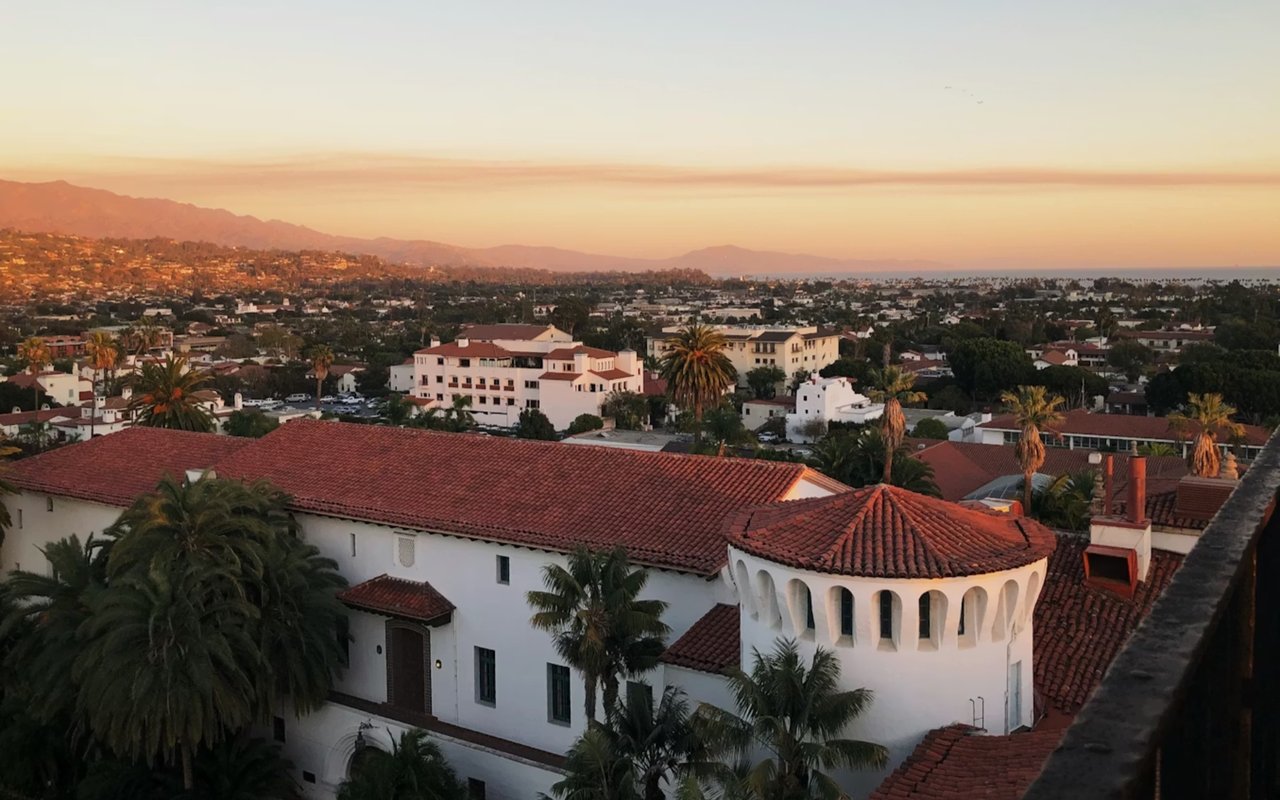
Santa Barbara's historic core centers on State Street and the El Pueblo Viejo district, while the waterfront runs from the harbor and Stearns Wharf past West Beach and up to the Mesa bluffs. The foothill band rises quickly near the Santa Barbara Mission and Mission Canyon, and the Riviera climbs above town with winding roads and broad view corridors.
If you’re deciding where to live in Santa Barbara CA, the local geography helps explain why the city can feel like several distinct markets within a short drive. Here's how to further distinguish between some of Santa Barbara's best-known neighborhoods.
Key Takeaways
- Upper East + Mission Canyon: Historic streets, foothill access, classic architecture
- Riviera: Elevated views, winding roads, estate scale
- The Mesa: Blufftop lifestyle, beach adjacency, roomy lots
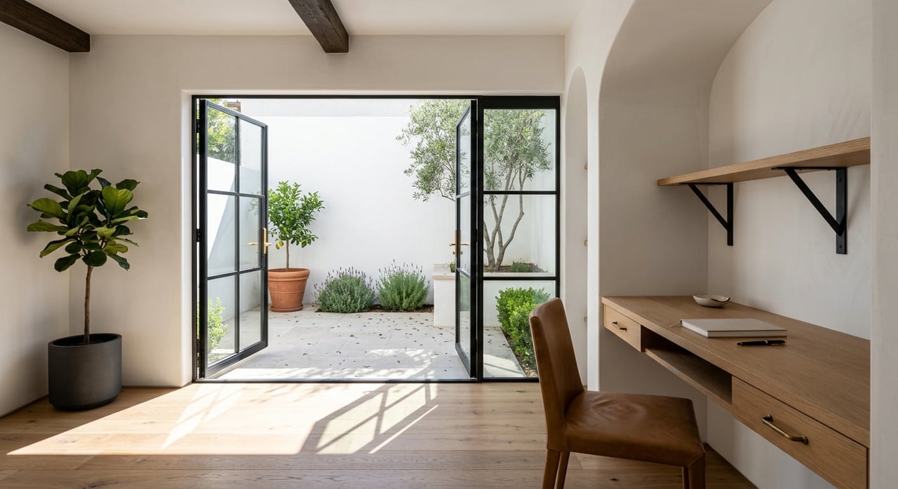
Upper East and Mission Canyon
If you want daily access to the Santa Barbara Mission and its rose garden, the Upper East and Mission Canyon keep you close to the city’s most iconic hillside corridor.
Why these local touchpoints matter here
- Santa Barbara Mission and Rose Garden: A walkable landmark for morning loops, photos, and weekend strolls.
- Foothill trailheads: Easy routes toward Inspiration Point and other front-country hikes from nearby access points.
- Architectural variety: Spanish Revival, Monterey, and classic California forms appear block to block.
- Garden-forward lots: Mature landscaping, privacy hedges, and curated outdoor rooms show up often.
The Riviera
The Riviera rises above town with curving roads, canyon pockets, and a “you can see everything” perspective that stretches from the harbor to the Channel Islands on clear days.
Why view geometry and access points matter here
- Ocean-and-harbor sightlines: Many properties aim living spaces toward the coastline and city lights.
- Belmond El Encanto vicinity: A recognizable reference point for the upper Riviera’s feel and elevation.
- Hillside street patterns: Curves, switchbacks, and smaller lanes shape drive times and privacy.
- Hidden stair routes: Neighborhood staircases support walking loops between terraced streets.
The Mesa
The Mesa sits on the west side above the water, and it brings a coastal routine that centers on Shoreline Park, Leadbetter Beach, and the blufftop feel that locals use daily.
Why this list helps you picture day-to-day life
- Shoreline Park paths: A go-to stretch for sunset strolls and open-water views above the bluffs.
- Leadbetter Beach: An easy spot for paddleboarding, beach walks, and relaxed afternoons near the harbor.
- Douglas Family Preserve: A coastal open space with trails, ocean air, and wide sky.
- Mesa lane patterns: Residential streets that feel tucked away while staying close to beach routes.
Downtown, West Beach, and the Funk Zone
Downtown Santa Barbara centers on State Street, historic El Pueblo Viejo details, and a walkable mix of restaurants, galleries, and tasting rooms. West Beach and the Funk Zone add a coastal edge near the waterfront, with quick access to Stearns Wharf, the harbor, and beach paths.
Why this list helps clarify the downtown-to-waterfront spectrum
- State Street core: Dining, boutiques, and cultural stops that shape everyday convenience.
- Stearns Wharf and the waterfront: Ocean views, harbor energy, and easy bike-path access.
- Funk Zone tasting rooms: Art studios, wineries, and a lively afternoon scene close to the beach.
- West Beach shoreline: A beach-adjacent feel with quick routes to the harbor and shoreline paths.
San Roque and the Foothill Corridor
San Roque and nearby foothill pockets run along the city’s north side, with a residential feel shaped by mountain views and easy routes toward the 101.
Why these local anchors help define the area
- Upper State corridor access: Coffee shops, markets, and everyday errands stay close and easy.
- Foothill backdrop: Mountain views and a sense of open space influence the neighborhood feel.
- Lot and home variety: You’ll see a mix of mid-century, updated ranch homes, and larger remodels.
- Commuter-friendly routes: Straightforward access toward downtown, Goleta, and beach areas.
FAQs
What neighborhoods feel closest to the beach lifestyle in Santa Barbara?
I usually start with the Mesa, West Beach, and pockets near the waterfront because daily routines can revolve around Shoreline Park, Leadbetter Beach, and the harbor.
Which areas tend to offer the biggest view impact?
The Riviera often leads the conversation for panoramic outlooks across the city and coastline.
How do I decide between in-town walkability and estate privacy?
I map your weekly rhythm first, then match it to neighborhoods like downtown for walk-to-everything access or Hope Ranch for acreage and privacy.
Contact Kendrick Guehr Today
If you’re zeroing in on where to live in Santa Barbara CA, I’ll build a short list based on the exact lifestyle markers that matter here, like bluff access on the Mesa, view corridors on the Riviera, and foothill proximity near the Mission.
Reach out to me, Kendrick Guehr, and we’ll share neighborhood-specific guidance on property types, micro-areas, and what to watch for in coastal versus hillside settings.
Reach out to me, Kendrick Guehr, and we’ll share neighborhood-specific guidance on property types, micro-areas, and what to watch for in coastal versus hillside settings.